Project Summary
OVERVIEW
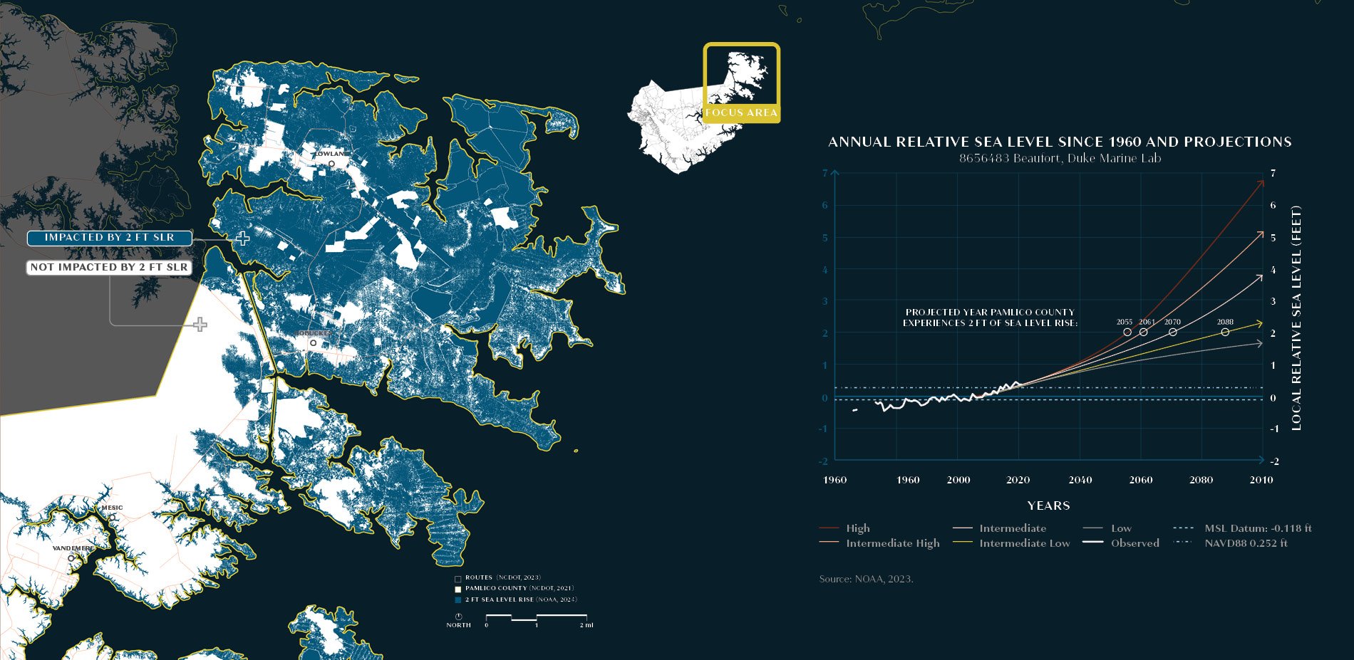
Water plays a critical role in Pamlico County's past and present. The county, founded in 1872, is named after the Pamlico Sound, the largest North American East Coast lagoon. Major water bodies in the county include the Bay River, Goose Creek, the Neuse River, the Pamlico River, and the Intracoastal Waterway. The county is separated from the Atlantic Ocean by the 200-mile-long Outer Banks.
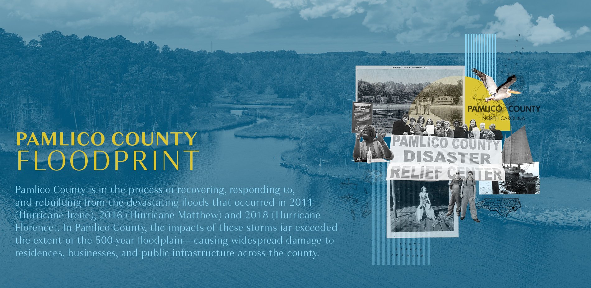
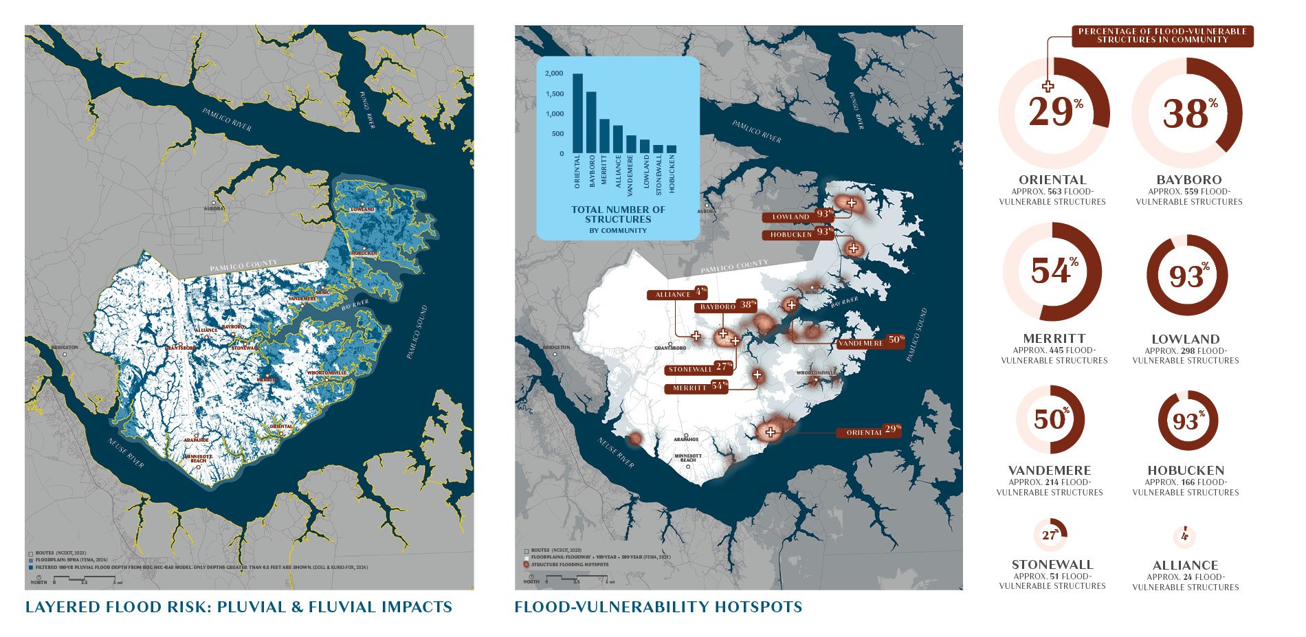
Pamlico County has been working to address challenges related to flood vulnerability, river access, and impaired water quality for nearly a decade. Severe flooding during Hurricane Matthew in 2016 and Hurricane Florence in 2018 exacerbated these issues. In Pamlico. The impacts of these storms far exceeded the extent of the 500-year floodplain in the county and the surrounding areas, causing widespread damage to residences, businesses, and public infrastructure.
The Pamlico County Floodprint aims to bolster these efforts by creating a framework plan to integrate existing initiatives within a new portfolio of flood mitigation projects informed by community input, rigorous analyses, and best practices in hazard mitigation. Ultimately, the material created through this process will serve as collateral for local leadership to attract, attain, and leverage external investments focused on implementing the projects and recommendations included in this report.
Funding Sources
North Carolina Office of Recovery and Resiliency (NCORR) / U.S. Department of Housing and Urban Development (HUD) CDBG-Mitigation Grant
Sample Images